
The Poort Stream
It seems that the exact source of the uMngeni River is not only a point of conjecture, but because it lies on private land, and out of sight of any road or resort, also an enigma.
The source is made up of a series of wetlands in an area labeled by Begg in his 1989 publication “The Wetlands of Natal”, as the “uMngeni Sponge”. The best known of these sponges is a RAMSAR site known as “uMngeni Vlei”, which is a protected area. However, anyone walking the reaches of the upper river, will find a strong tributary entering the main river a kilometre or two below where it descends off the escarpment at the farm “New Forest”.
In fact, the observant walker would probably notice that many times, that tributary is in fact larger and stronger in flow, than the so-called main river.
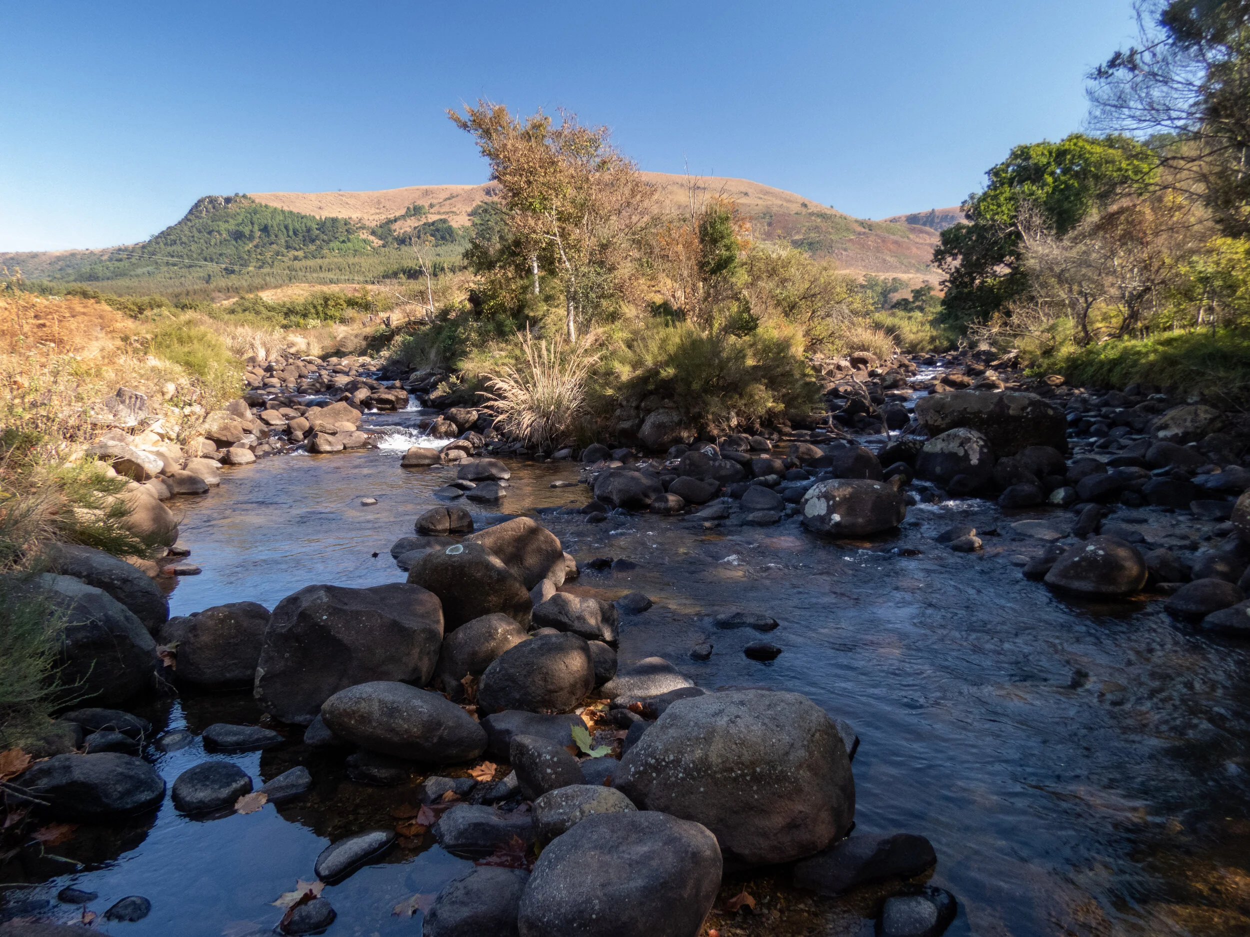
The confluence of the Poort Stream (left) and the uMngeni (right), at Umgeni Poort farm.
The Poort stream has its source in another wetland of the greater uMngeni Sponge, that being the Impendle Vlei. This vlei sits in a high rural basin, overlooked by the village of Kwanovuka, and falling under the jurisdiction of the Impendle municipality. This wetland has no legal protection. It is heavily grazed, but despite this, it is in good condition, and it is a beautiful place to visit.

From this 162ha wetland (which forms part of about 2,500 ha of the uMngeni catchment that falls into the Impendle municipal area), the water flows through a narrow “poort” and into further wetland and a man-made dam on Ivanhoe farm, where it is joined by other seeps and streams. “Working for wetlands” has done some recent wetland restoration work on Ivanhoe farm, and the owners and management are commendable custodians of this important area. This area is also very important wattled crane breeding and foraging ground.
At the base of this farmed area, on a farm called “The Fold”, the stream comes together into a pretty stream for just a few hundred yards, before it tumbles over a 60m high waterfall into a steep gorge below.

The Poort Stream just above the falls

The Poort falls, with Ivanhoe farm in the middle ground, and on the horizon, KwaNovuka village
In the gorge the stream runs through a tumble of boulders, with beautiful natural forest on its south-east facing slopes and open veld on the other side. There has been some invasion of wattle trees here, but thanks to the efforts of WWF and the landowner, this has been attended to, and with good fortune and a committed funder Upland River Conservation hopes to see to the ongoing maintenance work here.
A short distance further on, the stream becomes enclosed in alien trees, first as uncontrolled wooodlot, and then into a well managed commercial forestry area. We would love to be rid of the patch of woodlot, but it is steep difficult countryside…….maybe, just maybe, we will find a willing partner with the means to get this work started…
The stream emerges from the forestry area and trundles a few hundred yards through open grassland, where it then joins the uMngeni itself on Umgeni Poort Farm, where it flows at the toe of a beautiful natural forest.
Upland River Conservation’s projects that affect the Poort Stream are:
The Impendle Vlei inititiave (for the source)
Streamside restoration (for maintenance work in the steep gorge where WWF cleared)
uMngeni Co-Funded clearing (for that woodlot area that borders the commercial timber)
Visit the Projects page on this website to learn more about the above project proposals.